LogoAI Jet
Icon for Gaia GPS

Gaia GPS

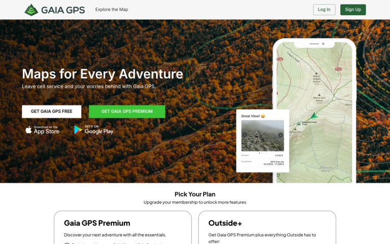
Outdoor navigation app with 300+ map layers for hiking, ski touring, and offroad adventures with offline capabilities.

Introduction

Gaia GPS

Gaia GPS is a comprehensive outdoor navigation application designed for adventurers who explore trails, backcountry terrain, and offroad paths. The app provides access to over 300 map layers including topographic maps, satellite imagery, weather overlays, and land boundary information.

Plans
Gaia GPS Premium

The core subscription offering essential navigation features including exclusive activity maps (Gaia Hike and Gaia Overland), offline map downloads, route creation, adventure tracking with real-time statistics, and weather/terrain planning tools.

Outside+

An expanded bundle that includes everything in Gaia GPS Premium plus access to Trailforks Pro for the world's largest trail collection, Outside TV for streaming films and live sports, MapMyFitness MVP, and full access to 10+ outdoor publications including Backpacker and Climbing.

Key Capabilities
  • Navigate Like a Pro: Access a catalog of 300+ maps with detailed trail guides curated by experts, including USGS and USFS topographic maps
  • Create, Edit, and Measure Routes: Plan trips using snap-to-trail modes, measure distances, and generate elevation profiles
  • Stay Safer: Weather, wildfire, and avalanche forecasts with terrain details like snow depth, slope angle shading, and cell coverage
Target Audience

Outdoor enthusiasts including hikers, backpackers, ski tourers, mountain bikers, offroad drivers, and anyone who navigates backcountry terrain.

Key Features
  • Exclusive activity maps: Gaia Hike and Gaia Overland
  • 300+ map layers including Cell Coverage, Private Land, and weather/terrain features
  • Offline maps for navigation without cell service
  • Create routes with Satellite, Private Land, Hike, and Overland maps
  • Track and record adventures with real-time stats
  • Custom waypoints and photos for marking key locations
  • Weather, slope, and wildfire layer planning
  • Snap-to-trail route creation modes
  • Elevation profiles and route distance calculations
  • Trailforks Pro access (Outside+ plan)
  • Outside TV streaming (Outside+ plan)
Use Cases
  • Hiking and backpacking trip planning and navigation
  • Ski touring and backcountry skiing route planning
  • 4x4 offroad trail navigation
  • Camping trip preparation with land boundary information
  • Mountain biking trail discovery and navigation
  • Weather and avalanche condition monitoring for outdoor activities
  • Offline navigation in remote areas without cell coverage
Pros
  • Extensive map library with 300+ layers
  • Offline map capability for remote areas
  • Comprehensive weather and terrain safety features
  • Expert-curated trail guides
  • Bundled outdoor content with Outside+ plan
Cons
  • Premium features require paid subscription
  • Outside+ plan includes many features some users may not need
  • Annual billing only
Pricing

Gaia GPS Premium: $59.90/year (billed annually, plus applicable taxes). Outside+: $89.99/year (billed annually, plus applicable taxes).

Latest News

Introducing the Gaia Hike Map: Plan Your Hike, Your Way - Gaia GPS

Introducing the Gaia Hike Map: Plan Your Hike, Your Way - Gaia GPS

8/4/2026

Introducing the Gaia Hike Map: Plan Your Hike, Your Way - Gaia GPS # Introducing the Gaia Hike Map: Plan Your Hike, Your Way March 18, 2025 At Gaia GPS, we eat, sleep, and breathe trails—well, maybe not literally, but pretty close. That’s why we’re rolling out the new Gaia Hike Map, designed to t...

Offline Snap-to-Trail Routing – Gaia GPS

Offline Snap-to-Trail Routing – Gaia GPS

8/4/2026

Offline Snap-to-Trail Routing – Gaia GPS Skip to main content As of Android v2026.3 and iOS v2026.4, snap-to-trail offline routing data is automatically downloaded with offline map downloads. #### Learn how to download maps and create routes here: - Download Maps for Offline Use - Create, Edit, ...

Gaia GPS is Improving Satellite Imagery: Saying Goodbye to Esri World Imagery - Gaia GPS

Gaia GPS is Improving Satellite Imagery: Saying Goodbye to Esri World Imagery - Gaia GPS

8/4/2026

Gaia GPS is Improving Satellite Imagery: Saying Goodbye to Esri World Imagery - Gaia GPS # Gaia GPS is Improving Satellite Imagery: Saying Goodbye to Esri World Imagery February 24, 2025 At Gaia GPS, our mission is to provide the best mapping tools for outdoor adventurers. To achieve this, we con...

A Fond Farewell to National Geographic Maps — And a Look at What’s Ahead - Gaia GPS

A Fond Farewell to National Geographic Maps — And a Look at What’s Ahead - Gaia GPS

8/4/2026

A Fond Farewell to National Geographic Maps — And a Look at What’s Ahead - Gaia GPS # A Fond Farewell to National Geographic Maps — And a Look at What’s Ahead March 26, 2025 #### Support for National Geographic Trails Illustrated maps in Gaia GPS will officially end on April 14th, 2025. We know ...

Gaia GPS x Toyota: A New Way to Give Back to the Trails We Love - Gaia GPS

Gaia GPS x Toyota: A New Way to Give Back to the Trails We Love - Gaia GPS

8/4/2026

Gaia GPS x Toyota: A New Way to Give Back to the Trails We Love - Gaia GPS # Gaia GPS x Toyota: A New Way to Give Back to the Trails We Love February 4, 2025 Alright folks, this is a big one. We all have that one trail—the one with the unbeatable views, the one that pushed us to our limits, the ...

FAQ

More Products

TinyPNG is Tinify’s browser-based image compressor and converter. This review explains how its web tool differs from its Developer API, what each free allowance covers, and when its compression, conversion, resizing, and cropping features may fit an image workflow.

Zamzar is an online file conversion and compression service for documents, images, video, sound, and other formats. Its free web service has daily file and upload-size limits.

iLoveIMG is a browser-based image service for compression, resizing, cropping, conversion, and editing, with a free Basic plan and paid options.

Smallpdf is an online PDF toolkit for conversion, compression, editing, merging, signing, and more. Its Free plan includes 30+ tools but limits downloads.

Convertio is a browser-based service for converting files between supported formats, with optional settings for many conversion types.

FreeConvert is an online file converter with more than 1,500 listed conversion types and a free allowance of 20 conversion minutes per day.

HiPDF is an online PDF service with conversion, editing, compression, merging, cropping, image tools, and AI features.

123apps is a browser-based suite of video, audio, PDF, and file-conversion tools. Its apps are free to use with limits on file size and daily operations.

ChatPDF summarizes PDFs and answers questions about them. Its free plan allows two document analyses per day, with no account needed to get started.

CloudConvert is a browser-based converter for more than 200 file formats, including documents, images, audio, video, archives, and specialist formats.

OCR.space provides free browser-based OCR for images and PDFs, searchable PDF creation, and a separate API for adding text recognition to software.

Free online itinerary maker with 900+ trip plans across 96 countries. Edit day-by-day in the browser; export to PDF, Excel, CSV, Google Sheets or .ics. Free account required to download/print. Optional Pro adds premium themes; AI chat helps draft plans.

TasteDir is a curated directory of finished, well-crafted software from indie makers and small teams. Every listed tool is reviewed by hand.

An AI meeting copilot that combines live transcripts, screenshots, and project documents to deliver contextual answers, response drafts, and meeting recaps.

Create professional invoices free in your browser: live preview, any currency, tax and discounts, custom templates, and no-watermark PDF. No signup needed.

Vidsembly is an AI video creation platform that turns PowerPoint presentations, PDFs, and documents into narrated videos. Create AI presentations, clone voices, translate slides, transcribe recordings, generate soundtracks, and host videos in one place.