LogoAI Jet
icon of Geotag Photos Pro

Geotag Photos Pro

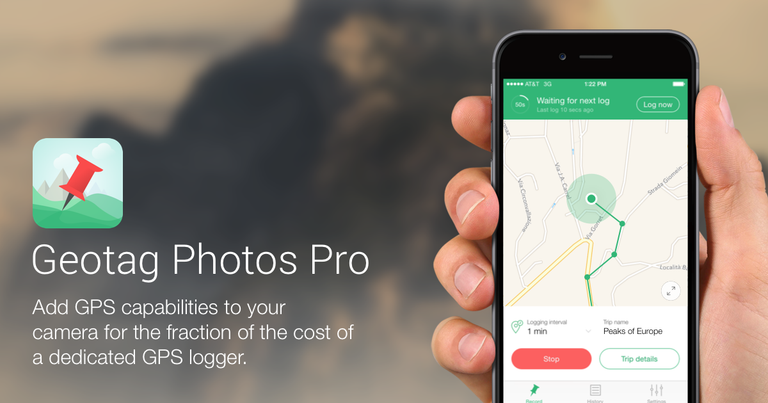
Geotag Photos Pro adds GPS capabilities to your camera, using a mobile app and desktop software to geotag images and export GPX files.

Introduction

Geotag Photos Pro is a comprehensive geotagging solution designed for both iOS and Android. It consists of a mobile app that records GPS data while you take photos and a desktop application that uses this data to geotag your images. Key features include:

  • Mobile App: Records GPS data with ultra-efficient battery usage.
  • Desktop App: Geotags images using recorded GPS data.
  • GPX Export: Exports recorded routes as GPX files via Dropbox, email, or web.
  • Lightroom Compatibility: Works seamlessly with Lightroom's Map module.
  • Smart Wearable Compatibility: Compatible with Apple Watch, Android Wear, and Pebble Watches for remote control.
  • Custom Settings: Offers adjustable logging intervals and accuracy settings.

Use cases range from casual photographers wanting to add location data to their photos from a walk to professional photographers needing precise geotagging for large photo shoots. It supports various digital cameras, including DSLRs, mirrorless, and point-and-shoot cameras, and is compatible with JPEG and most RAW file formats.

Alternatives

  • Adobe Lightroom Classic

    A comprehensive photo editor and organizer with a built-in map module for geotagging images using GPX tracks.

  • ExifTool

    A powerful command-line tool for reading, writing, and editing metadata, including geotagging photos from GPX files.

  • Photo Mechanic

    A professional photo ingester and browser offering robust metadata editing and geotagging capabilities with GPS logs.

  • Garmin eTrex Series

    Dedicated handheld GPS devices that record accurate GPX tracks, ideal for later geotagging photos from any camera.

  • HoudahGeo

    A dedicated macOS application for geotagging photos, providing various methods including matching images with GPX tracks.

  • GeoSetter

    A free Windows application that allows users to geotag photos by matching them with GPX files or manually placing them on a map.

  • Locus Map

    A feature-rich Android app for outdoor navigation that records precise GPX tracks, useful for geotagging photos taken separately.

  • OsmAnd

    A versatile offline map and navigation app for mobile that can record detailed GPX tracks for later photo geotagging.

  • Picca

    An iOS app specifically designed for geotagging photos by recording GPS tracks in the background, then syncing with images.

  • Google Photos

    Automatically geotags photos taken with smartphones and allows manual location adjustments, serving as a simple geotagging solution for many users.

FAQ

More Products

TinyPNG is Tinify’s browser-based image compressor and converter. This review explains how its web tool differs from its Developer API, what each free allowance covers, and when its compression, conversion, resizing, and cropping features may fit an image workflow.

Zamzar is an online file conversion and compression service for documents, images, video, sound, and other formats. Its free web service has daily file and upload-size limits.

iLoveIMG is a browser-based image service for compression, resizing, cropping, conversion, and editing, with a free Basic plan and paid options.

Pixelcut is an AI image and video platform with tools for background removal, upscaling, retouching, image generation, and product visuals.

Slazzer removes image backgrounds online. Its website offers free, low-resolution previews; higher-resolution downloads use credits.

Smallpdf is an online PDF toolkit for conversion, compression, editing, merging, signing, and more. Its Free plan includes 30+ tools but limits downloads.

Convertio is a browser-based service for converting files between supported formats, with optional settings for many conversion types.

Ezgif is a free online toolset for making and editing animated GIFs, converting videos to animations, and working with other image formats.

FreeConvert is an online file converter with more than 1,500 listed conversion types and a free allowance of 20 conversion minutes per day.

HiPDF is an online PDF service with conversion, editing, compression, merging, cropping, image tools, and AI features.

123apps is a browser-based suite of video, audio, PDF, and file-conversion tools. Its apps are free to use with limits on file size and daily operations.

ChatPDF summarizes PDFs and answers questions about them. Its free plan allows two document analyses per day, with no account needed to get started.

CloudConvert is a browser-based converter for more than 200 file formats, including documents, images, audio, video, archives, and specialist formats.

OCR.space provides free browser-based OCR for images and PDFs, searchable PDF creation, and a separate API for adding text recognition to software.

Free online itinerary maker with 900+ trip plans across 96 countries. Edit day-by-day in the browser; export to PDF, Excel, CSV, Google Sheets or .ics. Free account required to download/print. Optional Pro adds premium themes; AI chat helps draft plans.

Free face rater with visible symmetry and proportion diagrams, plus optional illustrated reports and six AI hairstyle concepts.